 |
 |


Veld, koppies & open spaces so near Jhb centre ...
Klipriviersberg Nature Reserve
This popular midweek hikes venue is just 11 km south of the Johannesburg city centre. It is an unspoilt 680-hectare stretch of open veld and koppies which boasts 150 species of birds and around 650 indigenous plants and trees. The Bloubosspruit, which flows through the reserve, is fed by four feeder streams found in the koppies.
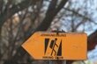
The Klipriviersberg Nature Reserve offers a network of trails, with guided walks and rambles up to 9km in length, conducted every second and fourth Sunday of the month.
In 1895 it was decided that the northern end of the reserve should be walled to form a dam to supply the needs of the rapidly growing town.
The foundations of the dam wall are still visible and the river flows through the middle of the wall, down through the reserve and into the Klip River. In 1899, the Anglo Boer War broke out and the plans were permanently shelved. Around £70 000 was spent on the Vierfontein dam scheme before it was abandoned. If the dam had been built, the suburbs of Mondeor, Alan Manor, Suideroord and Winchester Hills Ext 1 would not have existed.
Early history
The Klipriviersberge - 'stone river mountains' - have a long history. Stone Age artefacts dating back 250 000 years have been found in the reserve. Stone Age peoples probably hunted in the reserve but did not settle there as no living sites have been found. Aerial photographs of the reserve reveal 19 stone-walled Iron Age settlements dating from about 1500. A total of 90 sites have been identified in the broader area, suggesting a large, settled pastoral community.
Tswana people lived on the koppies, building stone walls to surround their inner kraals and living areas whilst cattle, their most important commodity, were housed in the inner circle, safe from predators.
These people traded with settlements at Melville Koppies, some 25 km north, who mined iron which was not found in the south. These peoples lived harmoniously but were overrun and wiped out in the early 1800s when ousted Zulu leader Mzilikazi moved into the area and established his kingdom.
Voortrekker farm
Around 1850, Sarel Marais, one of the early Voortrekkers, and his family settled just above the Bloubosspruit, in the southern part of the reserve. He built five elements of what characterised a typical 1850s farmstead: a farmhouse, a waenhuis or wagonhouse, an orchard, an irrigation furrow and a cemetery.
The single remaining wall of the wagonhouse provides an excellent example of pise-de-tere building technique: a 1.5 metre stone section with no mud cement, topped with a one metre mud brick section. The roof timbers consisted of right-angled yellow wood beams, combined with round poplar poles and held together with wooden pegs.
The family cemetery still exists, some 500 metres north of the house, now overgrown and vandalised. Sarel Marais' grave is in the cemetery. He died in 1897, aged 83.
A diary from the time indicates that lion, caracal, lynx and genet were found on the farm. Mountain rhebuck, duiker, jackal, mongoose, porcupine and dassie now live in the reserve.
Marais' son Jakob took over the farm when his father died, but since Jakob had no sons (he had 10 daughters from two marriages), he sold the farm in 1917 to the Quilliam family. They developed the farm, successfully farming dairy, with 10 000 pigs, growing lucerne, barley, and mielies.
Myrtle Coward, a second-generation Quilliam family member who grew up on the farm, describes her childhood as "absolutely wonderful". The orchard just below the farmhouse was flourishing in the 1930s. Lilian Thompson, Myrtle's sister, says: "fruits of every letter of the alphabet were grown in the orchard".
The City Council bought the farm around 1950, after most of the Quilliam family had left and grandfather Quilliam had died. His wife remained on the farm until it became unsafe for her to stay. Since she moved out in the mid-1980s, the farmhouse has burnt down and been vandalised, and all that remains are the walls.
Malcolm Holman, committee member of the Klipriviersberg Nature Reserve Association, grew up in the area and used to walk past the farmhouse on his way to hiking in the koppies with his friends. "I remember that grandmother Quilliam used to dash inside when she saw us coming down the road, and come out with cookies and lemonade for us."
Reserve proclaimed
The reserve was proclaimed in 1984. Access points:
- the one near the farmhouse is on Impala Drive;
- one through the Recreation Centre on Peggy Vera Road; and the most popular one,
- via Frandaph Drive in Mondeor, where the old dam wall is located.
One tree, the Buffalo Thorn, has several uses. "Its bark is used as a poultice for sprains," says Morne Brits, conservation consultant and reserve association member. It also has symbolic value, says Brits, in that the branches are cut and put on graves. There are paired thorns at the base of the leaves, the upward-pointing thorn symbolising the future, and the downward thorn referring to the ancestors. Furthermore, it is felt that it is safe to shelter under the tree in a storm, as lightning won't strike the tree. The leaves can be made into a tea or stewed, for use as an aphrodisiac.
The reserve is run by the Klipriviersberg Nature Reserve Association, with some 400 members, in conjunction with the Johannesburg City Council and Gauteng Nature Conservation. Gauteng supplies a manager together with 20 workers, who work seven days a week on clearing alien shrubs and weeds, and cutting fire breaks.
The reserve has a network of trails running through it. The longest about 9km. Organised walks take place every second and fourth Sunday of the month.
The reserve is unfenced and is used by local residents to walk their dogs. It is used as a thoroughfare between Mondeor in the north and Kibler Park in the south.
Klipriviersberg Nature Reserve, gives visitors "a feel for unspoilt Africa", says Brits.


![]()
 |
 |
 |